 |
The world famous Titicaca Lake

From the site of the Tiwanaku we drive to the nearby village Tiwanaku, which houses were mainly built from the stones and the rubble of the ruins , and on the walls even some redish broken bricks from broken pottery are visible. Shortly afterwards, we leave the main road in direction to the north, and I have a nap. Curiously, I do not notice the altitude of almost 4000m not earlier than during the third day of our Bolivia trip and feel a little nauseous, have a headache, feel tired and dizzy.
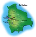 surely on the wrong way... We turn around the corner and, all of a sudden, it is in front of us: an endless water surface, the glacier mountains of the Cordillera Real reflect in itself at the horizon, there is reed growing at the shore, yes, this is it, the world famous and legendary Titicaca Lake on the Altiplano! surely on the wrong way... We turn around the corner and, all of a sudden, it is in front of us: an endless water surface, the glacier mountains of the Cordillera Real reflect in itself at the horizon, there is reed growing at the shore, yes, this is it, the world famous and legendary Titicaca Lake on the Altiplano!
I am suddenly waken up from my twilight sleep by a strong bucking. Through the window I see that we are driving through the complex, there is no road far and wide, we are buffeted in the bus but it does not seem to disturb the driver... I only think where are we going to, we are
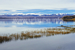
We stop at the shore and access a very shaky pier that is actually only a board to a small boat with its "captain" already waiting for us. as soon as we are all on board, the motor starts and we begin our boat trip of about one hour over the sea to the island Kalahuta; Enough time to have our well-deserved lunch that consists on fruits, sandwiches, chocolate bars and fruit juices and to listen to Erich giving us some interesting information about the Titicaca lake. First some data: The lake that is 304 metres deep is 195 kilometres long and 65 kilometres wide and, with 8562 square metres, it covers a surface that is 13 times bigger than the Lake Constance. From this surface, approximately 30% is from Bolivia, the rest is on Peruvian territory. The lake is subdivided into the bigger Chucuito-Lake (with 120 islands) and into the six times smaller Winaymarka-Lake (with 11 islands), whereby these two lake pieces are communicated by a water road that is only about 800m wide,the narrow place of Tiquina. The medium sea level is of 3810m height and therewith, the Titicaca Lake is the highest located navigable lake on earth.
For a lake of such a size it has on very few inflows with 25, and with the Rio Desaguadero there is only one outflow, but it is dried out all over the half of one year. The biggest part of the water evaporates by the strong mountain sun, a thing that results in the fact that the water is highly salt containing. I want to know immediately if this is true and put my arm from the reeling into the water and take some liquid. Thereby, I realize that the lake is very cold, approximately between 10 and 12 degrees, thus, only suitable for the hard swimmers! And in fact, the salt is clearly tastable. Despite of the cold water, the Titicaca lake is considered as one of the tropical lakes, as it is a heat reservoir for its surroundig, so that it is possible to cultivate some corn, barley, potatoes, peas and quinoa despite of the height of almost 4000m; We ask Erich where the name "Titicaca" actually comes from, and he also has an answer to that: Titicaca is composed of two Aymara words, Titi means puma and Caca rock, thus pumarock. This rock is located on the Isla del Sol, the sun island. The legends of it and also those all about the lake can be found in the page of the sun island.
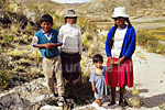
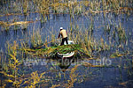
Our boat gets slowlier, we navigate through an extended belt of reeds and finally land at the island Kalahuta, one of the eleven Winaymarka-lakes. Again, a shaky pier, but we get with dry feet on firm ground. A weak upstream leads us to a dry bush and ichhu grass alongside the shore up to some old ruins from the Inca times and probably represented a temple and a burial ground at that time. In the proximity we see a peasant who is cutting some reeds from his boat, maybe for basketry or for covering the houses' roofs. Suddenly, we hear some loud screaming and before I realize anything, I am surrounded by some children. I carefully ask them, using my modest Spanish knowledge, if I can photograph them: "Si, si, dos Bolivianos por favor!" I give the children two bolivianos, but they do not seem to be too happy about it; After some gesticulations with their hands I understand that they want 2 bolivianos each. I think for myself not too bad, these children are already quite business-minded, the youngest of them is probably not older than three. Instead of more money, I offer them some chocolate bars and sweets, things they gratefuly accept. Immediately after this, they start to pose for being pictured and I can make my photography.
While I am busy making my picture, my group continues hiking a further piece so that I have to run behind them. We walk for about half an hour through a piece of the island nearby the shore, watch the sheeps and the cows looking for some food in this dried ground, local men repair their fishing boats while their women knit some colourful blankets and coats, a pure idyll! We walk only some steps further down to the lake and get again into the small boat that is supposed to take us 10 kilometres over the lake up to Huatajata. I am still very tired and doze off with the slight swing of the ship until I wake up by a strong bucking.
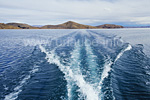
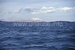
Some foam spatters against the window, the bosat is moved back and forth through the waves heighted more than a metre, we have to hold ourselves somewhere in the boat in order not to fall off the seats. What if we capsize here in the middle of the sea? There are two life jackets on board for nine people...But all of a sudden I am widely awake, go outside to the wind and try to make some photos until i am showered by a wave and i have to escape pretty wet back to the cabin. After some time, the storm calms down and fortunately, we all arrive safely at the landing point of Huatajata, where the bus is already waiting for us.
We drive on the main road coming from la La Paz alongside the lake through some small villages, passing some single farms up to San Pablo de Tiquina. There is a lot hustle and bustle there, as either the local people and also the tourists come together here in order to take the ferry to cross the constriction of Tiquina that connects both lake parts with each other. But "ferry" is actually the wrong expression, as we have to get out of the bus and are taken to one of the many shaky boats that is, according to my opinion, absolutely overcrowded. Our bus is loaded on another boat that rather looks like a float that is nailed together from many boards, not very trustful...
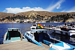
This is also the reason for the dividing, as if the bus sanks, then at least without us, I think. I am very happy when after only 800 m navigating but quite wet due to the high waves we finally arrive to San Pedro de Tiquina. We have to wait a little for our bus and take the opportunity to get some mineral water, chocolate bars and other small snacks at the numerus sales stands. And even our bus arrives safely and we can continue our way to Copacabana.
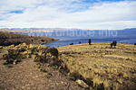
Right behind San Pedro, the bus turns in many hairpin bends some hundred altitude metres uphill on a mountain ridge that we follow for some time in a slight up and down. At the highest point, my altimetre measures almost 4400m, almost as high as the Matterhorn in the Alps! Erich tells us that the pollution also does not make an exception in the Titicaca Lake. The Peruvian big city Puno that is located at the western shore of the lake with almost 100.000 inhabitants conducts its waste water into the lake, and also a lot of heavy metals and other pollutants from the mines in the proximity get into the water and due to the evaporation and the missing outflows remain in the lake. The pollution and increasing fish dry there is a strong reduction of the fish population, thereunder trouts and salmons, a kind of catfish named suche and some other kinds of fish. Beside the fishes, the lake is the home of many endangered species like kinds of ducks, herons, ibises, cormorants and the Titicaca frog that weights up to 1000 grams. We shortly stop at the spot where we are at only a few metres distance from the Peruvian border and where we again have a great view back to the Winaymarka Lake.
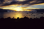
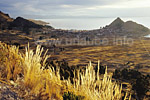
At the other side, the ridge that we had been following until then falls steeply into a plain at which edge the Copacabana is already visible in a small bay and that is illuminated by the warm evening sun. We drive down in steep hairpin bends to the plain and get soon to the first houses of Copacabana. The bus curves trough some narrow alleyways that despite of the dawn are still highly populated, and we arrive at the hotel, the Hotel Rosario del Lago, very closely located to the harbour. This hotel was already described on the page of La Paz, it is built in Toscanian style with some comfortably arranged rooms with a wonderful view to the lake. The staff is very friendly and helpful and in the longue, there is a free internet access with an open view to the harbour of Copacabana, in our case with a dream sunset. After this exhausting but culturally highly interested day we enjoy a very goog dinner, beef steak with quinoa and vegetables and a good chilled cerveza. Soon, we go tired and happily to bed and look forward to a new day at the Titicaca lake full of new experiences.

Back to the index Bolivia
Author: Flori Forster; Copyright: Patrick Wagner, www.tourist-guide.biz
|
 |