|
|
|
British Columbia's Interior PlateauBack to Vancouver on the Gold Rush Route 
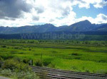
Our round trip leads on to the Interior Plateau, an area without high mountains but numerus mountain peaks of middle height. There, we will visit the city of Prince George and then continue on to Williams Lake. In the end, we come to Whistler where the surrounding mountains have heights of over 2,000m again. Stop 5: Prince GeorgeThe Icefields Parkway ends after 30 kilometres in Jasper, the Trans Canada Highway 16 leading back to British Columbia via Yellowhead Pass (1,066 m). At Mount Robson, highest point in the Canadian Rocky Mountains with its 3,954 m, we meet again with an old companion of our trip: Fraser River, who has its origin there. For the next 250 kilometres, it runs paralelly to the highway 16 between the Rocky mountains and the Cariboo Mountains. This part of the trip also has an appealing landscape, the mountains becoming less and less high the more you approach the Interior Plateau. The expression "plateau" should not be understood in this context as it is not a plain in any way . It is rather the case that most of the mountains here are less high than 2,000 m. Until reaching Prince George, the scenery is characterized by endless forests, which offered an opportunity to us to work up the manifold observations and impressions after the abundance of attractions in the national parks. The following part of the trip gives a good impression of the landscape that is characteristic for the North of British Columbia - where, by the way, we spent a whole three months - as you do not find any human settlement in large distances. 


Our companion during the whole trip as during the whole stay in the North of the province was one of the rare radio stations you can receive throughout all of British Columbia, even in the bush: Rock 101 Vancouver, one of the most brilliant radio stations on the planets, which offered a perfect soundtrack for the trip. It simply is fantastic to listen to "Hotel California" cruising in the Rocky Mountains at 80 km/h with the windows of your car down! A short way before Prince George, Fraser River continues on north but makes a sharp bend back after 30 kilometres and joins our route again in Prince George. Being the most important and largest city outside the Vancouver agglomeration with its 83,000 inhabitants, it also is the commercial and cultural centre of British Columbia's North and characterized by the timber industry. Vast saw mills and tree nurseries are evidence of the Canfor group's activities, who do business in the North of British Columbia; Geological landmark of Prince George, however, are the steep slopes of Nechako River, the Cutbanks. Stop 6: Williams Lake
Prince George was our stop farthest to the North on this trip. Highway 97 now lead us, steadily accompanied by Fraser River, back south; After about 100 kilometres, we reached Quesnel, from where it is interesting to make a detour using Highway 26 to remote Barkerville. Time seems to have stopped here as the village that was founded in the 19th century at the time of the Gold Rush features a large number of restored buildings dating from its founding period. Back in Quesnel, we continued on to Williams Lake, 120 kilometres away. Situated between the Fraser Plateau and the Quesnel Highland in a natural landscape, it is, with its 10,000 inhabitants, one of the most important towns in respects of the raising of cattle and timber industry and lies in the heart of the former Gold Rush region. This becomes especially obvious by the architecture of the wooden houses. Once a year, on July 1st, the big Williams Lake Rodeo, a stampede, takes place. This topic is also a subject in the town's museum that deals with the history of cattle raising and of the Rodeo. There also is the "B.C. Cowboy Hall of Fame" at Williams Lake. Stop 7: WhistlerFollowing Highway 97 further south, we reached 100 Mile House, a settlement of gold diggers that is also considered as North America's capital of hand-made wooden houses. It lives entirely on the timber industry and is surrounded by a thick network of logging roads, which means an opportunity to make an excursion to the forests around. Here, one can take the following as granted: anybody who has survived his or her first meeting with a timber truck will be safe from then on as the truck driver will immediately send a warning to all other trucks on the road (Seen where? Which direction? What car?) After another 100 kilometres we left Cariboo Highway 97 shortly before Cache Creek and took Highway 99 to the South. After 75 kilometres, our next destination was Lillooet, that once again is crossed by Fraser River. Lillooet also is part of the Gold Rush Route that leads from Vancouver to Prince George. The city is surrounded by dry high plateaus that realy live up to the name of Wild West. Sometimes, we now advanced rather slowly as the slopes leading up to heights of 1,300 metres are partially steep, as are the descents as well. However, the distance to be covered is foreseeable as Highway 99 - that is marked for about 150 kilometres as a secondary highway (partially paved, partially consisting of gravel) - gains in quality again from Pemberton on. We quickly reach Whistler, idyllically situated on Garibaldi Provincial Park between Whistler Mountain (2,181 m) and Blackcomb Peak (2,436 m). Here, one of the world's most famous skiing regions can be found where some contests in the course of 2010's Olympic Winter Games at Vancouver will take place. The contemplative town of Whistler is embedded in a little valley, surrounded by some lakes reflecting the mountain peaks around. From here there are 120 kilometres to go to Vancouver that truly can be called spectacular as the mountains show all of their beauty a last time to enter the visitors' memories here; En route, you drive through Squamish, a paradise for steep face climbers in the Coast Mountains. 
Back to British Columbia table of contents Author: Ingo Schmidt; Copyright: Patrick Wagner, www.tourist-guide.biz |
||