Transalp Stage 3: Sterzing, Italy
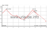
Schlegeis reservoir - Pfitscherjoch - Sterzing - Jaufenpass - St.Leonhard (80 km, 1800 hm)

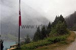
Day three starts! As always, the first view out of the window right after waking up - is it foggy? The range of vision is of approximately 50m! And it is drizzling! We do not have a look to the thermometre in the first place. We first go to have breakfast! In one hour, the sun is surely shining behind the fog! By this way, we motivate each other and try to enjoy our breakfast. The legs still feel a little heavy from the yesterday's climb and today, the most exhausting part is waiting for us.

We drive over the Pfitscherjoch (2251 m) to Sterzing and from there over the Jaufenpass (2214 m) to St.Leonhard in the Ulten Valley. In total, these are 80 km and an altitude of 1830 m on that day! The Pfitscherjoch is a valley crossing heighted 2246 m from Zamsergrund in the back Ziller Valley in Austria to the South Tyrolean Pfitscher Valley, that is a side valley of the Eisack Valley. The Austrian-Italian border runs alongside the yoke.
A walk together outside the door provides us with the certainty that today, the sun will apparently not shine anymore and that it is needed to wear warm clothes! There are 6 degrees! As we are close to the ridge of the Alps and there, the weather is not always nice.
Drive up to the Pfitscherjoch
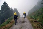
Well wrapped up, we start in direction to the Pfitscherjoch. The way leads on an unpaved path slowly upwards. A little later, the way gets more blocked and very hard to cycle on. The others continue trying on the saddle, I give up soon and push and/or carry my bike up, except on some few bits of the path where it was possible to cycle. After some good 1,5 hours I am standing on the top of the pass in a slight driving snow.

None of my mates for miles. Apparently, they already continued to the Pfitscherjoch house. after a short break and a cereal bar that help me against the growing coldness and tidyness, I bravely continue cycling for a small eternity until the hut appears in the fog and snowfall. I am completely soaking wet and happay to get a minestrone and a hot tea. The mates are there since one hour and already prepared to continue. Thus, I have to eat my meal fast, get changed into dry clothes and we start again to the long descent to Sterzing. Thankfully, I have some warm gloves and a cap, as these are really useful things during the descent.
Sterzing (Vipiteno)
One and a half hours, 20 km and 600 altitude metres later, we are standing in Sterzing in the readiant sun and cannot believe it!
We have some wonderful 20 degrees and a cloudless sky! We look for the next ice-cream parlor and peel ourselves out of the thick and wet clothes, what a relieve. The ice-cream, apple strudel and cappucino make us forget soon the unpleasant part of this tour.
Our view wanders further into the direction of the Jaufenpass. We still have to "earn" this pass height, as the actual endpoint of the excursion of today is St.Leonhard in the Ulten Valley. Sterzing (Vipiteno in Italian) is a city located in the upper Eisack Valley in South Tyrol. Beside the city itself, the locations Tschöfs, Thuins and Ried also belong to the community of Sterzing. Due to the location between the alpine crossings Jaufen- and Brenner pass as also Penserjoch, Sterzing was an important trade city for centuries. In the southern Wipp Valley, this city also has a big significance as a shopping city and business location.
The Jaufenpass
after a long extended break we first continue to cycle through Sterzing with its old streets and alleyways. At the end of the place we cross the Brenner Highway and we approach the pass road on a slightly ascending path. It gets increasingly narrow and tight and, unfortunately, also steeper. Hairpin bend by hairpin bend, the street curls upwards. Countless motorcyclists overtake us and of course a lot of cars also do. This route is not very pleasant for mountainbikers, but unfortunately we did not find an alternative route and/or it would have been a much too big detour. Thus, we look forwad to arrive up there and to really enjoy later on the long descend into the Ulten Valley.

The Jaufenpass (Passo di Monte Giovo n Italian) is a pass in South Tyrol. At a height of 2099 m above sea it connects the Passeier Valley at St. Leonhard in Passeier with the Wipp Valley at Sterzing (Brenner Road). The road is very curvy, has 20 hairpin bneds and a length of 39 km. The Jaufenpass is the most northern inner Italian Alp Pass and the shortest connection between Meran and Sterzing. I connects the Sarntaler and the Stubai Alps.

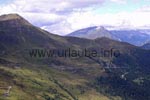
At the north of the pass road, the Ötztaler Alps tower, and at the south, the Sarntal Alps. The pass is surrounded by the mountains Jaufenspitz (2.481 m) and Saxner (2.359 m) as also by the wide Ratsching Valley. On the top of the pass it is painfully cold and windy. We quickly change our sweaty t-shits, get into our windbreakers, have something to drink and we already descent. We hace a race with the motorcyclists and arrive safely in St. Georg after a diversified day. There, we check-in at the hotel and let the day end as usual by having a nice meal and drinks.
Ulten Valley is a valley of a length of 40 km in South Tyrol, Italy. It runs paralelly to Vinschgau located at the jnorth and extends from the National Park Stilfserjoch up to Lana in the Meraner Land (Burggrafenamt). The biggest part of the Ulten Valley belongs to the community Ulten.

Back to the index Transalp
Author: Kirsten Huber; Copyright: Patrick Wagner, www.tourist-guide.biz
|