Outback - The No Man's Land of Australia

The Australians consider the regions that are far away from any civilization as outback. The outback of Australia includes approximately three quarters of the surface of the fifth continent. Not only the Northern Territory and West Australia belong to the outback, also a part of the Federal States Queensland, New South Wales and South Australia belong to it.
The Outback offers the most different landscape formations and climate zones. In the outback, which is also denominated as no man's land by many travelers, there are extremely dry regions, specially in the west. Here, there is partly not a drop of rain falling for some years and the temperatures rise in the summer time to more than 50°C; these areas are absolutely inaccessible.
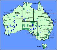
Due to the flame red earth in the centre of Australia, the outback is also called "The Red Centre"; those who have been once there know what I am talking about. It is an indescribable sensation to be in this no man's land, this quietness, heat and despite of the flame red and dry earth, there are still different plants and animals to be looked at. Everyone who travels once to Australia should in any case travel through the red centre, not until then one can join a conversation and one knows what the world talks about when it is said: the famous outback of Australia.
Alice Springs - The Gate to the Outback
Alice Springs, a small city amidst the red centre in the Australian outback, has approximately 27.000 inhabitants. I flew from Sydney to Alice Springs, exactly 3,5 h flight over the no man's land. By looking out of the plane's window, one only sees different red colours and simply a nothing. I first thought, oh my god, where to I get there, but it is a must if being in Australia and an undescribable feeling free of stress and hectic, simply quietness...
Alice Springs is the only big city in the outback of Australia and quasi the gate from the infrastructure to the outback, it is, believe it or not, a a 1500 km distance from the other big cities of the country. Alice Springs is the most important initial point into the red centre. Alice has its own flair, from a little dusty Outback area up to modern restaurants, hotels and a small shopping mile called Todd Mall, here one finds everything related to the Outback, specially a lot of cultural elements of the aborigins who mostly have their home here in Alice.
Specially in the late evening hours, many aborigines meet in the centre of the city. Tourists should not be on the way in the evenings on their own here; in every travel guide, it is recommended to take a taxi to the accommodation when it gets dark in order to avoid eventual assaults or orther discomforts. In the following I describe some of the recommendable sightseeings of Alice Springs:
Alice Springs Desert Park
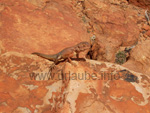
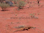
In the year 1997, a desert park was opened that was only approximately at a ten minutes distance from Alice Springs. It is the newest attraction of the region. Here, one can see more than 140 kinds of animals and 350 kinds of plants; A typical desert flora grows in a natural environment. It is said that here, one can see in a short time more than during an outback-tour of several days. The loop road in the park has a length of approximately 1,6 km; on this way, one can look at different typical forms of landscapes in the outback. The park is located in the Larapinta Drive.
Royal Flying Doctor Service
In the Royal Flying Doctor Service, one is sufficiently informed about the medical attendance for the people who live far from the civilization on isolated farms. But also the tourists that need medical help during a trip through the outback are attended personally, I have also visited the station and have been very fascinated and impressed of the work there.
Adelaide House
The Adelaide House is the first hospital that was designed in the region and inaugurated in the year 1926. It was designed by the founder of the flying doctors John Flynn (1880-1951). Today it is considered as a national museum with exhibitions of the period of promoterism and describes the life of the referee John Flynn.
The Adelaide House is located in the Todd Mall in Alice Springs. The pedal-driven radio station was developed in a hat that was located behind the former hospital of John Flynn and a German technician named Alfred Traeger. In memory to John Flynn, the Memorial Church was arranged in the year 1956 beside the Adelaide House. The ash of the referee rests at the border of the mountains at the west of the city underneath a round boulder (Flynn's Grave Historical Reserve).
Panorama Guth
Those who want to see a panorama picture of a width of 60m and a height of 6m can view the artwork of Henk Guth at the Hartley Street. It shows the landscape of the Red Centre of Australia.
Museum of Central Australia
In this museum at the Ford Plaza in the Todd Mall, people get their money worth who have a strong interest in the culture of the aborigines as also in the natural history.
Mineral House
Beside the geology and the mineral decomposition of central Australia, also the permits for the search of minerals and gems are shown. This house is located in the Hartley Street.
MacDonnel Ranges
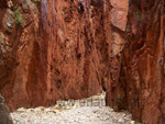
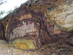
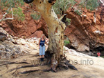
The fascinating canyons of the MacDonnell Ranges belong to the biggest attractions in the proximities of Alice Springs .Seen from the west of Alice, the West MacDonnel Ranges expands for approximately 160 km to the west. The eastern MacDonnel Ranges are considered as an insider tip for travelers, they offer a range of enchanting geologic and geographic attributes.
Old Telegraph Station
At the North Stuart Highway, 3 km at the north, there is an old telegraph station that belongs to the most well worth seeing and historically most significant buildings of Alice Springs. Here, the history is specially exposed by old items on display. There is a big park surrounding the building that is considered as a popular place for picknick. Those who want to have a refreshing bath should take their cooling in the Alice-fountain of the proximity.
School of Air
This centre that is located in the Head Street can be visited by everyone. It is about a school that teaches the children who are in the far back fields in the outback through the radio network of the flying doctors.
Anzac Hill
Those who want to have a view all over the city can enjoy it from the Anzac Hill. Here are the well-kept and artificially irrigated green areas and ranges of trees as also the lineal road network of Alice visible. One also has a dream view to the chain of the Mac Donnell Ranges in the south. The Hill is located at the Wills Terrace, at the northern suburbs of Alice.
Frontier Camel Farm
In front of the massive coulisse of the Mac Donnel Ranges, the Frontier Camel Farm is located. Here, camels and dromedaries are raised on an extended date palms plantation. Here, the animals are already considered as tradition, as in former times, up to the year 1927, the place was supplied by dromedary caravans; Not until the year 1927 the railway line was arranged with which Alice Springs could be accessed.
A ride on a camel as also the visit to the camel museum and the neighboured reptile museum are included in the entrance fee. A highlight is the Camel Cup on mid of May; here, the dromedaries with their riders are in a race competition. Everything takes place at the Ross Highway at 6 km east of Alice Springs.
Ghan Preservation Society
In this museum, specially railway fans fully get their money worth. A railway station was reconstructed that shows the old Ghan railway. Twice a week, it is possible to have some excursions in an historical locomotive on the rails of the old railway line. This complex is located at the MacDonnel Siding, Noris Bell Avenue, approximately at ten kilometres from the south of Alice.
Bojungles Bar
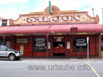
For those who do a lot of viewings during the day and want to go out cozily in the evening and meet nice people, I highly recommend the famous Bojungles Bar in the core of Alice Springs. Here, one mainly meets backpackers from all over the world and the atmosphere is wonderful, so that one can cozily bring the evening to an end in the no man's land. Everybody of course has a lot to tell, the things that one experienced during the day or until then during the trip through Australia.
The Kings Canyon in the Watarrka National Park
Kings Canyon is the biggest canyon of the Red Centre and is a part of the approximately 72.000 hectares sized Watarrka National Park in the George Range. The enchanting sandstone walls that partly are more than 200 m high appear as if they were downright cut off with a knife. At the ground of the canyon, there are some enchanting water holes in which one can partly bath and a unique flora.
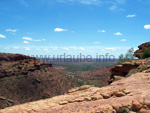
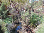
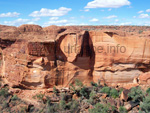
Those who hike over the Kings Canyon Walk, a thing that is very recommendable, will get to the "Garden of Eden". Here, one sees a bright vegetation, that partly belongs to a former and more humid climate period. On the plateau over the enchanting canyon, some sandstone cupolas of different sizes developed by some alterations. Due to their similarity to deteriorated streets and houses they are also called "Lost City".
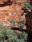
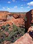
There are two possibilities to explore the Kings Canyon. One of them is located on the Kings Canyon Walk, the one I personally made and can highly recommend. This way offers an enchanting view into the valley and specially to the vertical rock faces as also the petrified sandstone cupolas on the plateau. The ascend leads over a steep path that is only recommendable to the sportive and fit travelers during the hot summer heat.
This way first leads over a very steep path to the northern flank of the rock cliffs, then one crosses the Kings Creek, and a cooling is possible in the greenly overgrown Garden of Eden. The way back takes place over the south side through the beautiful sandstone cupolas of the "Lost City". The whole way is of a length of approximately 6 km and takes approximately 4 hours.
Ayers Rock - An emblem of Australia
The Uluru National Park that is approximately sized 126.000 hectares does of course not only comprehend the rust coloured Ayers Rock, but also the rust coloured rock groups of the Olgas that are a little isolated, also called Kata Tjuta. As the Ayers Rock is specially a very important element in the mythology of the aborigines with its different sanctuaries, in the year 1985, the area was returned to the Pitjantjatjara-aborigines. This is why in the language of the Pitjantjatjara, the oficial name is "Uluru", but this name cannot push the more common name "Ayers Rock" in the background.
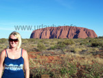
The natives have borrowed the rock for 99 years to the Australian National Park & Wildlife Service the touristical use. Since then, the park is administrated by the representants of the aborgines (Uluru/Kata Tjuta Board Management. The Ayers Rock is named after Sir Henry Ayer, prime minister of South Australia 1855-1897.
Most of the more than 2000 resident aborigines are vanished or live in the so-called outstations and barely take part on the beneficial tourist business. In the year 1987, the UNESCO has included the park into the "Worlds Heritage List", since then, the unique natural monuments as also the flora and fauna are under world-wide protection.
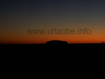
In the desert-like sand plain there is only a scant dry vegetation, spike grass and isolated bushes and trees, the so-called Desert Oaks. In the protected area at the bottom of the rocks, rainwater accumulates if it rains at all, a thing that during the summer months can occasionally occur. Then, some worthseeing blossom carpets of wildflowers develop, then one can even see the Stuarts Desert Rose, the escutcheon flower of the Northern Territory. Those who want to see some animals should best try this in the very early morning or around evening. But the most fascinating are the colour games of the Ayers Rocks and the Olgas during the sunset but also during the sunrise.
Here, there is a desert-like climate with a relatively high evaporation. Duting the day, it is mostly very hot; but during the winter months, the mercury bar occasionally falls under the freezing point. This is hard to imagine but it is really like this. In have been in January at the Ayers Rock and during the day it was very hot and in the evenings one had the feeling that one freezes to death. Very strange, but it is so.
Ayers Rock Resort
In the year 1984, the very sophisticated Ayers Rock Resort was inaugurated, it is located outside the National Park. Through the colourful architectural arrangement it well integrates into the landscape. The resort is arranged like a small city; it has a campsite, shops, restaurants and an information centre for the national park. The resort also includes an observatory from which it is possible to see the southern starry sky.
Ayers Rock (Uluru)
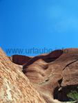
This abundant and colourful sandstone has a height of 348m, a length of 3,4 km and an amplitude of 8,8 km. The Ayers Rock consists on sandstone and conglomerates; in the course of the milleniums, they were strongly inclinated through tectonic movements. The extremely strong contrasts of temperatures, water and wind highly affect the big rocks. After a cetain period of time some grooves and fissures and real cavities emerged on some areas. Depending on the position of the sun, the oxidized iron minerals provide some enchanting colour games.
During the sunset, this colour game is the most beautiful, then the nearly flame red monolith raised from the dark backround. This is best seen from the Sunset Viewing Area; it is located between the rocks and the resort. It is barely less impressive during rain, because then it shines metallic, black-grey and shiny white due to the spume of the water masses that fall from the rock.
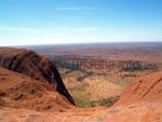
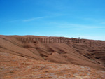
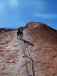
In the mythology of the Australian natives, the Ayers Rock is a sanctuary and it is a taboo to access the rock. But the fewest visitors are aware of the fact that by accessing the rock, they disregard a sainthood of the natives. Since a certain period of time, the natives discuss about a prohibition of access. It is said that those who want to respect the natives will abstain from the access.
Unfortunately, I have to include myslf to those who accessed the Ayers Rock, I was not really conscious about what this really means to the natives and I thought this is a uinique experience and a long looked-for dream to access this very beautiful but still spooky mountain. The march up to the top of the mountain takes an hour, but those who have time should also go to the Uluru Circuit Walk that takes approximately 3-4 hours. Here, one passes some sanctuaries as for example caves, rock formations and water holes that are to be respected accordingly. Ayers Rock is an undescribable and wellworth seeing adventure and wonder of nature
The Olgas
The Olgas, also called Kata Tjuta that in English means something like "many heads", rise at approximately 32 km viewed from the Ayers Rock out of the desert-like plain. The highest cuppola of them is the Mount Olga heighted 546m. Once, the Olgas were a massive rock massif. Due to the material of the rocks, the destroying forces of the alteration, the complex has been split into single cupolas. There are exactly 36 cupolas rising from the ground and they are really impressive.
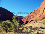
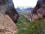
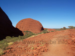
There are three parking places from which some hiking paths that are very easy to access lead to the area of the rock cupolas. From the northern parking place, a circular route leads to the Valley of the Winds in 2-3 hours, it is an undescribable experience to explore the Olgas. I can only highly recommend this walk , as I explored it by myself and it was a real dream. From the parking place at the west one gets in eastwards to the Mount Olga Gorge Walk, which takes 1-2 hours. It is also possible to hike between each of the cuppolas of the Olgas. But one should be prepared for some difficult climbing tours; most of the times, signpostings are missing.
3-Day-Adventure Trip to Ayers Rock
Those who are already in the famous Outback of Australia should in any case take the time to make one of the tours of several days in the Red Centre to the Uluru/Ayers Rock; Personally, I can highly recommend the tour with Mulgas, specially the cost/performance ratio is right. Moreover, one makes the acquaintance of many nice people from all over the world.
I paid for the tour with Mulgas only 250 A$ for three days/2 nights, food, transport, entrance fees and camping equipment. Those who do not have an own sleeping bag have to pay additionally 5 A$. Approximately 20 persons take part on the tour and one really sleeps in the wilderness in a so-called swag at a bonfire, very romantic, as Australia has an enchanting starry sky that I did not experience anywhere else in the world.
The following things should be taken to such an adventure tour; the principle of the organizers is "as few as possible": sun lotion and specially a headgear, a mosquito net that can be put at nights over the head (it is not a must but I can only recommend this), insect spray and of course very good and comfortable hiking shoes, as one hikes up to 10 km per day.
We started at 6.00 a.m. in the morning and all participants seemed to be still tired, so that after all got into the bus, the snoring competition started before one realized that he is on one of the most exciting adventure tours. After having driven a few kilometres over the red pistes, our tour guide Clen explained us the course of the next days.
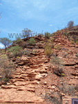
After that we got the first sandwiches (indeed very tasty but no necessarily for three days); After we were on the way for five hours we arrived at our first destination, the Kings Canyon. Here, there are three different walks to explore around the famous Canyon. The tours differ in length and diffilculty from each other.
In our case, all felt like coping with the most difficult level, so that we choosed the Kings Canyon Walk that takes three hours and has a length of 6 km. I can only say that sweating and the effort was worth it. This has to be seen, it was a totally impressive view. Actually, the walk is only very steep in the beginning, where one really sweats, but then it is something that almost everybody can handle.
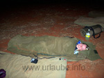
There is always enough food provided throughout the complete tour, one does not need to worry about that. There were repeatedely sandwichs and snacks. The nights were spent in so-called swags. These are bigger sleeping bags made of a thick material with a matress inside, and one puts his sleeping bad into this swag; this should be done in any case, as the nights are very cold in the outback, the way one would have never guessed.
During the daytime, one nearly swelters and in the nights one thinks that one will to freeze to death and feels like winter. The swag must be pulled over the head; it protects specially against dirt and wind and of course also against unwanted little animals; The mosquito net should be also pulled over the head, as the insects in the outback are insupportable.
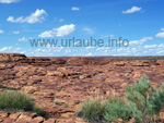
We then layed in the evening under a dream starry sky around a bonfire; our guide provided us some tasty food, and by this way we could let a wonderful day come to the end. I have to say that it was also a little spooky feeling not to have a tent over one's head and to listen to the sounds of the animals that were not visible; it was very adventuresome and an unfogettable experience to me.
In the following morning, we continued at a very early time to a view point from which one can watch the sunset at the Uluru and at the Olgas at the same time.In this morning, it was very cold so that one should be packed in a warm jumper or a wind coat. It was a very touching moment when the sun rised over the Uluru.
After that we first had breakfast on a parking place, so that we were really recovered before getting to the next walking track. Specially the warm coffee and tea were very good doing so that we could get warmed a little. After breakfast we continued to the Olgas; as it was still not very warm, it was the exactly the right thing to start with the next track. I did not know before that that the Olgas are so nicely impressive. Here, there are also different walking tracks. Clen walked the track with us that took approximately 1,5 hours. It is recomendable to circle the complete olgas, as the huge sandstone cupolas are very impressive if one stands in front of it.
After we all safely arrived at the meeting point, we immediately continued to the Uluru; Everybody had been waiting for this enchanting mountain, as everybody associates Australia with the Uluru and I have to say it was a dream moment that I will never forget.
First we visited the Cultural Centre at the Uluru, a thing that is a must. Here, one can look at the artworks of the aborigines and buy them as a souvenir; also, the significance of the Uluru for the aborigines and their culture can be learned here. After that, we drove to the basis of the Uluru where one first awestrucked of joy, as the view is so impressive. In reality, the Uluru is much more beautiful than it appears on postcards or on tv; simply undescribable!!! Clen told us several things about the mountain and one does not notice until standing in front of it how big and enchanting this natural wonder is.
In the evening, we drove then to a parking place that is located close to the Uluru where we had dinner during the sunset at the Uluru. The sunset was as impressive as the sunrise was in the morning. During the sunset, the colours of the Uluru continuously changed ans it was so mystic to watch this natural wonder. On the parking place, all people were quiet and firstly let have the effect on them. It was so quiet that one could hear a pin drop. After the natural wonder we continued to our bivouac, where we again let the next wonderful day in the outback of Australia come to an end.
In the next morning, we had to get up very early again; that day we were allowed to walk around the complete Uluru, we looked forward to this and those who dared also had the possibility to venture the steep and dangerous ascend to the Uluru. In order to respect the aborigines, one should not access this mountain. This is indicated in every travel guide. But I could not resist climbing on the Rock, I broke my rules and climbed up to the peak. I felt so free and it was a wonderful feeling, I could not believe to be standing on this red mountain in question of which everybody talked about.
The walking track around the Uluru is barely 10 km long, a madness, but everything is at ground level. Depending on how fast one walks, the track takes 1-1,5 hours; one can also walk the track by wearing flip-flops.
Around the Uluru, there are the so-called sacred places, which mean sanctuaries at which it is prayed and not allowed to take any pictures. Those who still dare to do so and get caught have to be prepared for a penalty of up to 5000 A$. As there are enough possibilities to make pictures of the Uluru from all perspectives at which it is allowed, one should respect the petition of the aborigins and abstain from it at the sacred places.
After another day full of adventures in the Red Centre of Australia was over, we returned back to Alice Springs, again a trip of approximately 4,5 hours. But also a trip of several hours through the Outback is impressive, here, one can see a lot of feral animals as camels, specially a lot of kangaroos.
After we arrived in Alice Springs, we all met in a resturant for a good-bye dinner and had a party up to late at night. The trip to the outback was one of my most beautiful experiences in Australia. Those who are still not sure if they should do this adventure trip should not continue thinking about it.

Back to the index Australia
Author: Simone Palm; Copyright: Patrick Wagner, www.tourist-guide.biz
|