Gorgeous hiking tour to the Schwarzsee (2582m)

One of the most beautiful hiking tours that can be done in Zermatt leads up to the Schwarzsee at the bottom of the Matterhorn. But the way to get there is not determined at all. Two hands are not enough to count the ways and variants that lead from Zermatt to the Schwarzsee. One can choose a stretch and start marching by following strictly the map, but one can also simply start walking from Zermatt and follow the signposts. One will always find the way to the Schwarzsee, the only question is one's benefit of each way.
The variants of the ways increase significantly by considering the funiculars. With the aerial cableway Matterhorn-Express, one gets from Zermatt also in ten minutes quickly up to the Schwarzsee or only up to Furi, in order to start the hiking tour from there. We choosed a wonderful route up to the Schwarzsee and came back to the valley by cableway. But if I knew before that only the way down with the cableway would cost approximately 15 € per person, we would have prefered to take the footway.
Hiking tour from Zermatt up to Zmutt (1936m)
From Zermatt, we continuously walk alongside the valley in direction to the Matterhorn until a signpost indicates the way to the right in direction to Zmutt. After only a few minutes, the stream of the setting off hikers are split. Most of the mates that also go to the Schwarzsee, choose the direct tour over Furi and Hermettji. This route goes practically straightway and without loop ways up the mountain, indeed, one is rewarded with nice views downwards to Zermatt, but there is not much more to see on this direct route.
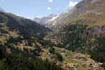
The way into the Zmutt Valley is wonderful and quiet. Here, people friendly greet each other by meeting other hikers on the way. The landscape of meadows, floodplains and forests are as taken from the picture-book. During the whole way, one finds repeatedely some little huts and wood sheds that stand on stilts. We also came across to some marmots on the way to the Zmutt Valley. During the way, one should not feel disturbed if one is supposedly clambering up on the wrong side of the valley, one will cross the valley, but much later.
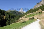
After approximately one hour hiking, one arrives to the little village Zmutt. From the distance, it is hard to believe what is to see there. Zmutt appears as a picture-book village amidst the green floodplain as the village's task was to be a kind of customs station for the hikers going in direction to the Zmutt Valley. In fact, there is practically no way around Zmutt, but only the curiosity attracts one to the center of the little hamlet.
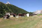
During the visit of Zmutt, one becomes a witness of an aged Walser colony. Here, it is understandable at best what I already wrote in the entry page about the Walser colonies: the little place is located on a sunny meadow that is protected against avalanches; around, there is enough space for the agriculture and thanks to the Zmutt brook, there is also a huge abundance of water. And of course, in the middle of the village, there is a little white chapel. Today, Zmutt lives only from the tourism of course, in principle, the little village is a big restaurant that invites the hikers to rest. Many are in transit as we are, but come also from Zermatt or from the station Furi on a half day excursion to Zmutt only for having lunch.
One should confidently have a break in Zmutt, as either the place as also the view is worth to see. One reverently looks up to the Matterhorn and outside the valley, one sees the Rimpfischhorn and the Strahlhorn glistening in the sun. Apropos sun: to date, the hiking tour almost proceeds exclusively at the sun. Thus, a sun lotion and a hiking hat are some indispensable items of the equipment.
Von Zmutt bis zur Stafelalp (2200m)
On the way to Zmutt, we saw repeatedely the mighty Zmutt Glacier. Those who are enthused by the glaciers can continue walking from Zmutt on the right valley side to the Schönbielhütte. The Schönbielhütte is located at a height of 2694 m and is at the very back of the Zmutt Glacier. But the hiking tour is quite a task, as a glacier with its moraines is located in the way. But the view to the glacier and the Matterhorn is phenomenal.
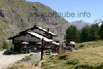
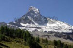
But in Zmutt, we cross the valley on a little bridge, under which there is a deep fall into the canyon. In the background, a dam is visible and behind it, the storage lake. But what kind of storage lake is this? There are no turbines, under which help, electricity could be produced. It sounds unbelievable, but it is a Swiss masterstroke: the storage lake has the only function to storage the glacial water, in order to redirect it to the storage lake Lac des Dix that is located two valleys further. One can imagine the technical effort behind this to arrange subterranean tunnels and equalizing reservoirs over the whole mountain chains.
After we crossed the valley near Zmutt, our way continues at the other valley side in direction to the Zmutt Glacier up to the lower Stafelalp. A little further above, the upper Stafelalp at a height of 2200 m is waiting and invited to have a picknick there and get refreshed. But before sitting at the sun terrace, first, one has to enjoy the views, as one is almost right underneath the northern wall of the Matterhorns. One is already so close to the mountain of the mountains, that one has to look up reverently to the summit. Here, the Matterhorn is the most beautiful, that is as an isolated and well-shaped peak amidst a green forest and meadow landscape.
From the Stafelalp up to the Schwarzsee (2582m))
There is hustle and bustle at the Stafelalp. One wonders where all these people come from. The mountain hikers coming from Zmutt are rather a minority. Many people come over walking from the funicular station Furi. And many more come down from the Schwarzsee. While on the way from the Stafelalp one friendly greets each hiker that comes across one's way, this cordiality ends on the way to the Schwarzsee, as the closer one gets to the famous lake, the more the masses come towards one. Every Tom, Dick and Harry, child and dog, sandal wearers and complete travel groups walk downwards to the Stafelalp. From now, quietness and isolation is completely out of question.
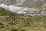
Anyway, the hiking tour of approximately one hour from the Stafelalp up to the Schwarzsee (2582 m) is a great enjoyment. By each meter gained in altitude, the views get increasingly phenomenal. The most beautiful bit leads across a huge mountain meadow alongside the bottom of the Matterhorn. I even think that that for this short stretch, we needed 1,5 hours, as we repeatedely sat on one of the numerous benchs in order to enjoy the mountain panorama. While at the Stafelalp at the very bottom only the northern side of the Matterhorn is visible, on the way to the Schwarzsee, the south-east side increasingly appears.
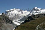
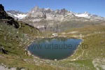
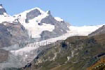
What is specially impressive are the views to the Zmutt Glacier; one sees the full summit panorama all around the glacier. At the Zmutt Glacier, one can clearly see how the glacier withdrawed in recent time: a huge side moraine and a smoothly grinded mountain face show exactly how far the glacier once advanced into the valley.
While walking up the green floodplain, the curiosity increases of what is waiting beind the hilltop. Up to the Schwarzsee there are still some metres of altitude left, but the Monte-Rosa- and Lyskamm-Group increasingly appears in the background. And after finally having reached enough altitude, one has a sensational view to these two four-and-a-half-thousanders summits. The glacier that is visible underneath the summit, is no other less than the Gorner Glacier.
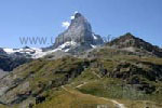
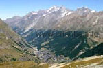
After crossing the lateral mountain flank, we finally arrive at the Schwarzsee. During our hiking tour from Zermatt, we climbed up 960 m altitude. We were more than 4 hours on the way, although this tour could also be made within two hours, if one abstains from having breaks and stops for taking pictures. Up at the Schwarzsee, of course there is a swarm of tourists, but therefore one is compensated by many sightseeings. In the Schwarzsee-restaurant, we first tapped ourselves a litre of water and took a salad plate filled to the rim in the budget from the buffet m Buffet, before we unhurriedly enjoyed all the fascinating views to all directions.
We soon noticed that what applies to the other beautiful mountain lakes also does for the Schwarzsee: the mountain scenery could be wonderfully reflected on the water, as it is always visible in the famous pictures. But as a slight wind blows most of the time and there are children and dogs playing in the water, the lake has waves so that there are no nice mirror images on it.
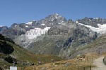
For those who do not get enough with an altitude of 2582 m, can get up to the mountain house of the Matterhorn at a height of 3260 m. What first starts as a simple hiking path gets increasingly difficult during the last metres. For us, the views to the north eastern flank were absolute sufficient. Anyhow, the views to the distance were much more impressive. Suddenly, the little city Zermatt located 960 m deeper seems now really tiny and jammed by both mountain sides. It is to consider that from the right side of the Mattertal, from Zermatt up to the Dom, one sees 3000 m altitude at once.
And, of course, a view over to the Strahlhorn and the Findeln Glacier should not be missed. Those who already had a trip with the Gornergrat see a big part of the railway stretch right in fron of them. From this side, the Gornergratbahn is even more imposing as it anyway already is.
Yes, it is easy to spend a lot of time at the Schwarzsee. And if the time would not have been so advanced already during our hiking tour, we would be surely now on our return way over Hermettji and Furi to Zermatt. But this way, we got angry after a wonderful day about the fact that the trip to the valley with the gondola cost approximately. 15 € per person.

Back to the index Zermatt
Copyright: Patrick Wagner, www.tourist-guide.biz
|