|
|
Barranco del Infierno - The most beautiful water fall of Tenerife
One of the most beautiful walking-tours that can be made in Tenerife is the tour to Barranco del Infierno. It is a canyon on which end the biggest water fall of Tenerife runs into the valley. This walking-tour is very simple but still diversified. It takes for the two ways approximately 3 to 4 hours including breaks and has a length about 8 km. Either on the way there as also on the way back, one walks approximately at an altitude of 250 metres. 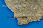
The tour starts in the village Adeje, that indeed has only a few thousand inhabitants but is growing strongly. The whole coastal part below Costa Adeje is named as the village. Here, the beach Playa de las Américas is located, that is highly desired by the tourists. The location Adeje is easily to access either by bus as also by car. In the main street of Adeje there are many little cafés and bars that invite to have some tapas. From Adeje, numerous traffic signs lead to the famous Barranco del Infierno. Still before the real walking-tour begins, one has to walk up a blind alley that is geting more and more cliffy; on this street, there are also plenty of parking places for the visitors with a car. At the end of this road there is a restaurant from which the walking path starts directly. 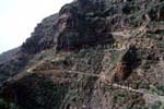
Translated, Barranco del Infierno means canyon of hell, but this is out of question. The well arranged walking path begins approximately 200 metres upside the canyon and leads at the south west part of the mountain side into the canyon. The way is very easy to walk, as it continuously has a width of about 1 metre; at precipitous passages it is secured by wooden piles. During the first hour, one is permanently exposed to the sun; this is why one should put some lotion before the walking and eventaully take a head cover to the tour. First, the path goes up before it leads down to the canyon; Numerous viewpoints allow a continuously deeper insight into the canyon and offer the possibility to have a break. As one is really permanently exposed to the sun, one feels more and more like entering deeper into the canyon where there are shades and some cooling. 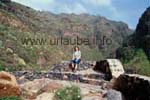
At the beginning, there are indeed not only fascinating views into the canyon but also outside the valley to Adeje and the sea. Thus one should not only storm forward but also sometimes look back. It is fascinating how the rock faces of the right canyon side come closer. Finally, the walking path leads a last piece downwards, where one has the first contact to the canyon beck and also finds the desired shade. 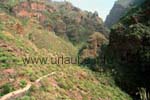
From the bottom of the canyon, the mountains at the left and the right seem to be huge. One feels to be really tiny. There is an interesting formation at the right peak of the following picture: a huge whole is inside the mountaintop. In this stretch of way one also finds two aqueducts on which a water conduit is carried. The upper aqueduct is very old and carved of wood. At the end of the walking path there is a last "real" resting place before one gets into the shades of the nountain ranges. From now, the character of the path changes completely; While until now, one was walking alongside some dry hillsides that were nearly vegetationless on wide walking paths, now one accesses an alluvial forest that is rich of vegetation, in which it is for some degrees colder than before. 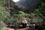
Well smelling blackberry bushes, plants of all colours and different kinds of climbers grew exuberantly in a way that they were obstacles of the path that henceforth it could be only talked about a lumping path. While for the children the plants were not a "threat", as an adult, one had to make oneself very small in order to go forward. At the beginning, one crosses every now and then the beck on little bridges. After a certain time, these bridges only consist on big stones in the beck. The closer one gets to the end of the canyon, the more one gets in touch with the beck, as the path simply disappears. The beck must not be simply crossed any more, but to walk real stetches of way within the beck. Of course, there are numerous rocks in the beck, on which one can - as long as one always keeps the balance - keep his shoes dry. 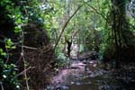
The wild briar is not any more simply at the right and at the left side of the beck, but also above oneself; A view to the mountain peaks is hardly possible any more. One also hardly gets ahead, as one is very busy with keeping the balance. I remember very well how a hiker who was coming from the opposite direction said to me that there are only 300 metres left until the water fall, but I needed a quarter of hour for these 300 metres. At the last bit, the path goes a little up before one finally reaches the water fall. At this part of the path it is nearly a master stroke to keep the feet dry. Also, every now and again one has to grab with the hands, as for example by clinging on the rocks if one is crossing a bigger obstacle. But this part is also not dangerous, the only risk is to get wet feet in the warm water. The picture at the right shows a first water fall at the left side of the path; but this is not the real water fall for which one has been waiting nearly two hours for. 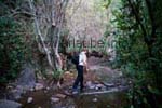
In the high summer, the beck is hardly filled with water so it is a child's play to reach the head of the valley. But instead, one only sees a lightly dropping rivulet as a water fall. In the winter or after it had rained, the path through the brook bed is more ambitious; but therefore, one finds a magnificient water fall at the end of the canyon. 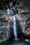
Finally, one reaches the little plateau with a small but shallow water basin in front of it, in which the water fall of the Barranco del Infierno falls. One stands and this spot with a lot of respect, surrounded by mighty rocks. It is a place that is never reached by a sun ray. Even in the summer at noon time, the place still remans dhadily. The three cascades of the water fall can be only seen if one walks up to the backside and climbs a little on the rocks. The tour through the Barranco del Infierno is really one of the most beautiful tours in Tenerife. The reason why it is so interesting is because it has two completely different characters: first, one walks the biggest stretch of way on a wide walking path at brusque hillsides in the heat of the burning sun; then one walks alongside the beck in the shady canyon up to the end of the valley. There, one is rewarded with an impressive view to the biggest water fall of Tenerife; Even if some might be deterred by the balancing act in the brook bed, this part of the path is the one which makes most of fun. Except of getting some wet shoes, nothing can happen. Copyright: Patrick Wagner, www.tourist-guide.biz |
||
