Transalp Stage 2: Zillertal, Austria
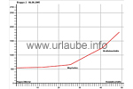
Fügen - Mayrhofen - Breitlahn hut - Dominikus hut (50 km, 1320 altitude metres)

Day 2! Today, the mountains of the Zillertal are cloud-veiled and the regular rain does not make it easier to get up from bed. The weather forecast predicts snowfall up to 1300 metres. We have an extensive and tasty breakfast and, dressed with raingear, we motivadely start in direction to the south hoping the weather will get better.
Mayrhofen
Our first stage desination is Mayrhofen at the end off the Zillertal. The place is located at a height of 640 metres and due to the 1,3 million overnight stays there, it is the second biggest tourist place of Tyrol. The respective infrastructure in the trade, business and service sector is connected to that. The tourism started to develop in the year 1879, when the Hut of Berlin was openend, and soon, more rifugios followed in the Alps of Zillertal. Another impulse was provided by the Zillertal railway that was inaugurated in the year 1902. The later building of the penken and Ahorn cable made Mayrhofen develop to an internationally renowed holiday resort.

Once arrived in Mayrhofen, we choose one of the little nice coffee bars of the pedestrian area. There, we ger refreshed with a cappucino and some huge pieces of cake, and after reading the map and getting changed, we continue - without any rain!- in direction to Hochsteg/Ginzling. This is a total of 8 km and 300 altitude metres. From there, we continue to the ascend in direction to the Schlegeis reservoir and to the Dominikus hut, at 1805 metres, to our destination of the day. From mayrhofen to the dam crest of the Schlegeis reservoir at the back Zillertal, the stretch offers a very diversified profile. At the limit of Mayrhofen, we stay on the federal highway B 169 in southern direction, at the kilometre 31, the ascend with an incline of 10 - 12% begins. After some few hundred metres, the main road turns to the left and leads up through a tunnel.

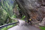
But we have the old connection road across an impressive canyon with partly overhinging rock faces. Slowly, we increasingly gain altitude until we get after 5 km back to the main road that leads to the mountaineer's place Ginzling with only a little incline. Ginzling is the last bigger settlement located at the back Zillertal at a height of 990m and is also the starting point for hiking tours to numerous huts and mountain pastures, as also to countless mountain- and ski tours up to the glacier regions.
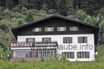
From Ginzling there are approximately seven kilometres with some alternating flat and steep passages up to the tollgate at the guesthouse Breitlahner. Here, one has again the possibility to have an extensive break. But we continue cycling to our actual destination, the Dominikus hut. After some narrow serpentine roads and two sufficiently illuminated tunnels we rapidly gain some altitude.
Schlegeis Reservoir and Dominikus hut


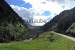
The destination is already in a deceiving visual range, but apart from the way up to the dam, there are still four final hairpin bend with an incline of approximately 13% waiting for us. The Schlegeis reservoir is a popular destination for excursions, this is why the street has to be shared with buses and cars. Specially during the descent, one has to be very careful!
The Dominikus hut is located at the south-east declivity of the Olperer and beautifully located right at the reservoir. The toll road leads from Ginzling up to shortly before the hut. This road has been created by the Tauern power houses, was required for the building of the reservoir and is called "Alpenstrasse Schlegeis". by the end of the 60ies, the Tauern power houses corporation started with the building of the dam of the Schlegeis-reservoir.


The old hut had to be given up as otherwise it would have sunk in the reservoir. On July 15th of the year 1970, the partial damming was started and the complete damming was completed in the year 1973. As a replacement for the old hut, the Tauern power houses built a considerably bigger two-floored building at a higher level. The name of the Dominikus hut was kept, although the new house rather deserved the name guesthouse. The private Dominikus hut is the initial point for visiting the Olperer hut, the Pfitscherjoch house and the Furtschagl house as also the surrounding mountains.
We are very happy to stand in fornt of the hut and having arrived savely after 1300 altitude metres and almost 50 km.We get accommodated on the second floor and after an extensive shower and washing our clothes we go downstairs in order to have dinner.

Back to the index Transalp
Author: Kirsten Huber; Copyright: Patrick Wagner, www.tourist-guide.biz
|